In an era where information is paramount and precision is key, Geographic Information Systems (GIS) mapping emerges as a beacon of innovation, revolutionizing how we understand, analyze, and utilize spatial data. From urban planning to environmental conservation, from disaster management to business intelligence, the applications of GIS mapping are as diverse as they are profound. Let's embark on a journey to unravel the significance and the myriad applications of GIS mapping in today's dynamic world.
Understanding GIS Mapping:
At its core, GIS mapping is the art and science of capturing, storing, manipulating, analyzing, and presenting spatial or geographic data. Unlike traditional maps, GIS maps are dynamic, interactive, and layered with information beyond mere geographical features. Through the integration of various data sources, including satellite imagery, GPS data, demographic information, and land surveys, GIS mapping enables us to gain insights into spatial relationships, patterns, and trends that might otherwise remain hidden.
Applications Across Industries:
Urban Planning: In the realm of urban planning, GIS mapping serves as a vital tool for visualizing infrastructure, zoning regulations, and demographic trends. Planners can simulate scenarios, assess the impact of proposed developments, and optimize resource allocation to foster sustainable urban growth.
Environmental Conservation: GIS mapping plays a pivotal role in environmental conservation efforts by facilitating habitat mapping, biodiversity assessment, and land-use planning. Conservationists leverage GIS technology to identify ecologically sensitive areas, monitor deforestation, and devise strategies for preserving natural resources.
Disaster Management: During times of crisis, GIS mapping proves indispensable for emergency response and disaster management. By overlaying real-time data on hazard zones, population density, and infrastructure assets, responders can make informed decisions, allocate resources efficiently, and coordinate rescue efforts to mitigate the impact of natural calamities.
Business Intelligence: Businesses harness the power of GIS mapping to gain a competitive edge in an increasingly interconnected world. Location-based analytics enable retailers to identify optimal store locations, marketers to target specific demographics, and logistics companies to optimize supply chain routes, ultimately enhancing operational efficiency and customer satisfaction.
Emerging Trends and Technologies:
The landscape of GIS mapping is continuously evolving, driven by advancements in technology and the growing demand for spatial intelligence. Some noteworthy trends include:
Remote Sensing: With the proliferation of satellite imagery and aerial drones, remote sensing has become a cornerstone of GIS mapping, allowing for the acquisition of high-resolution spatial data over large areas.
Cloud-Based GIS: Cloud computing has democratized access to GIS tools and data, enabling seamless collaboration, scalability, and real-time updates across distributed teams.
Machine Learning and AI: The integration of machine learning algorithms into GIS workflows promises to enhance automation, predictive modeling, and spatial analysis, paving the way for more accurate and actionable insights.
3D Mapping: Beyond traditional 2D maps, the adoption of 3D mapping technologies enables users to visualize and interact with spatial data in three dimensions, revolutionizing applications in urban design, architecture, and virtual reality.

Geographic Information Systems (GIS) have become an essential tool for comprehending our planet in today's digitally connected world, when every part of the world is just a click away. The use of Geographic Information System (GIS) technology has transformed several fields, including environmental management and urban planning. And now that GIS 3D modeling has been developed, the options are even more astounding.
Imagine being able to explore cities, landscapes, and entire regions in stunning three-dimensional detail, right from your computer screen. That's the promise of GIS 3D modelling—a technology that is reshaping the way we visualize and interpret geographic information.
At its core, GIS 3D modelling combines the power of GIS with advanced rendering techniques to create immersive, lifelike representations of the world around us. By incorporating elevation data, satellite imagery, and other geospatial information, GIS 3D models provide a depth of insight that traditional maps simply cannot match.
One of the key advantages of GIS 3D modelling is its ability to provide a holistic view of the terrain. Whether you're planning a new development, assessing flood risk, or studying geological formations, being able to see the landscape in three dimensions can reveal patterns and relationships that might otherwise go unnoticed. This enhanced understanding can lead to more informed decision-making and more effective resource management.
But GIS 3D modelling isn't just about visual appeal—it's also about practicality and efficiency. By simulating real-world scenarios in a virtual environment, planners and analysts can test different strategies and scenarios before implementing them in the field. This not only saves time and money but also minimizes the risk of unintended consequences.

Furthermore, GIS 3D modelling has applications beyond the realm of urban planning and environmental management. For example, it can be used in archaeology to reconstruct ancient landscapes and visualize historical sites. It can also aid in disaster response efforts by providing emergency responders with detailed, up-to-date information about affected areas.
Of course, like any technology, GIS 3D modelling is not without its challenges. One of the biggest hurdles is data acquisition and processing. Creating accurate, high-resolution 3D models requires vast amounts of data, as well as sophisticated algorithms for processing and analysis. Additionally, ensuring interoperability and compatibility with existing GIS systems can be a complex undertaking.
Despite these challenges, the potential of GIS 3D modelling to transform the way we understand and interact with our world is undeniable. As technology continues to advance and data becomes more readily available, we can expect to see even more innovative applications of GIS 3D modelling in the years to come.
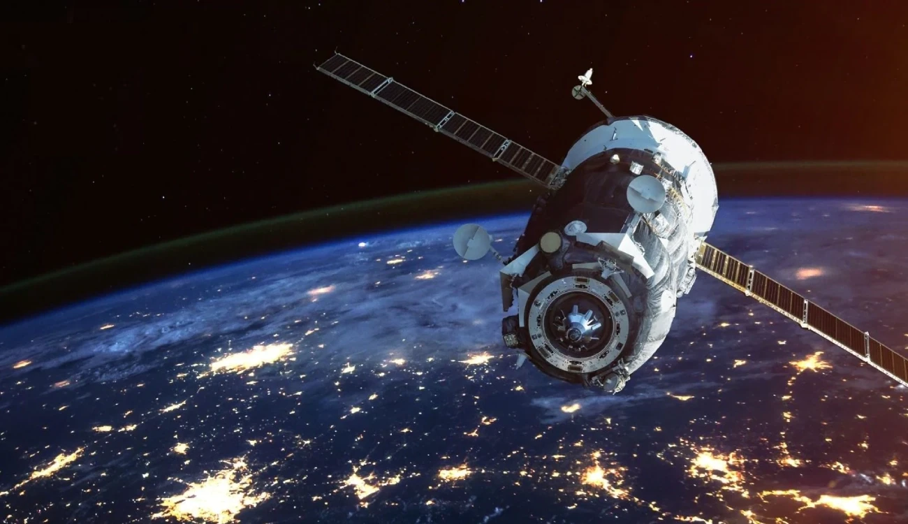
With satellite mapping, we ascend beyond the confines of conventional cartography, delving into a realm where boundaries fade, and perspectives shift. Satellite mapping harnesses the power of orbiting satellites equipped with state-of-the-art sensors and imaging technology to capture high-resolution data of the Earth's surface. These satellites, orbiting hundreds of kilometers above, become our eyes in the sky, providing a bird's-eye view of the world below.
The applications of satellite mapping are as diverse as the landscapes it captures. From urban planning to environmental monitoring, disaster management to agriculture, the insights derived from satellite mapping are invaluable. Let's explore some key areas where satellite mapping plays a pivotal role:
Urban Planning and Development: In burgeoning cities where every inch of land holds immense value, satellite mapping offers urban planners a comprehensive understanding of existing infrastructure, land use patterns, and demographic trends. By analyzing satellite imagery, authorities can make informed decisions regarding zoning regulations, transportation networks, and sustainable development initiatives.
Environmental Monitoring and Conservation: Our planet is facing unprecedented environmental challenges, from deforestation to climate change. Satellite mapping provides researchers and conservationists with real-time data on changes in land cover, biodiversity hotspots, and habitat fragmentation. This information is instrumental in devising conservation strategies and monitoring the impact of human activities on fragile ecosystems.
Disaster Management and Response: In the wake of natural disasters such as earthquakes, floods, or wildfires, timely and accurate information is critical for effective disaster management. Satellite mapping enables emergency responders to assess the extent of damage, identify areas of vulnerability, and coordinate rescue efforts swiftly. Furthermore, satellite imagery aids in predicting and mitigating the impact of future disasters through risk assessment and early warning systems.
Precision Agriculture: Agriculture stands at the forefront of technological innovation, with satellite mapping revolutionizing traditional farming practices. By analyzing multispectral imagery and terrain data, farmers can optimize crop yields, monitor soil health, and manage irrigation more efficiently. Satellite mapping also facilitates precision agriculture techniques such as variable rate application of fertilizers and pesticides, leading to sustainable farming practices.
Infrastructure Development: From laying down roads and railways to building bridges and power plants, infrastructure development shapes the trajectory of societies. Satellite mapping provides engineers and project managers with accurate topographic data, enabling them to plan infrastructure projects with precision, minimize environmental impact, and ensure optimal utilization of resources.

As we journey deeper into the realm of satellite mapping, the possibilities are limitless. With advancements in artificial intelligence and machine learning, we are witnessing a paradigm shift in how we analyze and interpret satellite imagery. Automated algorithms can now process vast amounts of data, extracting actionable insights and uncovering hidden patterns that elude the human eye.
However, as we marvel at the wonders of satellite mapping, we must also be cognizant of the ethical and privacy implications associated with this technology. The proliferation of high-resolution satellite imagery raises concerns regarding individual privacy, surveillance, and data security. It is imperative for policymakers to establish robust regulations and safeguards to ensure responsible usage of satellite mapping technology while upholding ethical standards and protecting civil liberties.
For More Info:-
GIS
gis mapping
maps in gis
gis maps
gis map
GIS Services
gis 3d modelling
Digital Mapping
satellite mapping
LULC
land use land cover
land cover mapping
Land subsidense mapping